


Fabbri, Bryan (2025): Basic measurements of radiation at station Granite Island (2025-02) [dataset]. NASA Langley Research Center, Hampton, PANGAEA, https://doi.pangaea.de/10.1594/PANGAEA.980515 (DOI registration in progress), In: Denn, Fred M; Fabbri, Bryan (2024): Basic measurements of radiation at station Granite Island (2019-01 et seq) [dataset publication series]. NASA Langley Research Center, Hampton, PANGAEA, https://doi.org/10.1594/PANGAEA.971609
Always quote citation above when using data! You can download the citation in several formats below.
Published: 2025-04-02
Other version:
Fabbri, Bryan (2025): BSRN Station-to-archive file for station Granite Island (2025-02) [dataset]. ftp://ftp.bsrn.awi.de/gim/gim0225.dat.gz
Project(s):
Coverage:
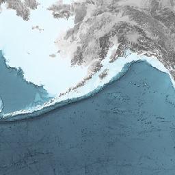
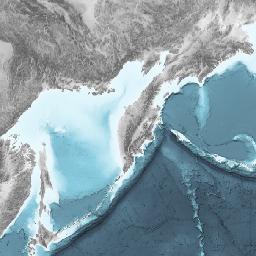
Latitude: 46.721000 * Longitude: -87.411000
Date/Time Start: 2025-02-01T00:00:00 * Date/Time End: 2025-02-28T23:59:00
Minimum HEIGHT above ground: 2 m * Maximum HEIGHT above ground: 2 m
Event(s):
GIM (Granite Island) * Latitude: 46.721000 * Longitude: -87.411000 * Date/Time: 2018-07-01T00:00:00 * Elevation: 195.0 m * Location: Lake Superior, Michigan, United States * Method/Device: Monitoring station (MONS) * Comment: BSRN Station No. 78; Surface type: water, lake; Topography type: flat, rural; Horizon: doi:10.1594/PANGAEA.931000; Station scientist: Bryan Fabbri (bryan.e.fabbri@nasa.gov), Fred Denn (frederick.m.denn@nasa.gov)
Comment:
- Solar tracker turned off at ~1530GMT on 2025-02-06 (Feb. 6, 2025) in anticipation of heavy freezing spray. This was a preventative measure to protect the solar tracker from operating in heavy ice conditions.
- Solar tracker was turned back on at ~1400GMT on 2025-02-10 after the ice melt/sublimated from the solar tracker.
- Solar tracker turned off again at ~1530 GMT on 2025-02-28 for preventative reasons due to another forecasted heavy freezing spray weather event.
- Downwelling diffuse (DIF) and downwelling direct (DIR) data not available on the days the solar tracker was turned off. However, the component summation indicated a probable soiling of the DIR measurement. Therefore, all DIR was deleted starting 2025-02-07 through the end of the month. We believe SWD is OK, however, it is possible it was also soiled but to a lesser extent than the DIR. NOTE: The optics, including DIR and SWD, were cleaned 2025 March 13.
- Downwelling LW (LWD) and downwelling Global (SWD) are available the entire month.
- 2025 Feb. 11 had frost on the optics for some part of the morning hours and the SWD, DIR, DIF and LWD data were deleted.
- The ventilators (fans) were first known to have failed on 2025 Feb. 1. The fans were not fixed until the following month (Repair date: 2025 March 13).
Parameter(s):
| # | Name | Short Name | Unit | Principal Investigator | Method/Device | Comment |
|---|---|---|---|---|---|---|
| 1 | DATE/TIME | Date/Time | Fabbri, Bryan | Geocode | ||
| 2 | HEIGHT above ground | Height | m | Fabbri, Bryan | Geocode | |
| 3 | Short-wave downward (GLOBAL) radiation | SWD | W/m2 | Fabbri, Bryan | Pyranometer, Kipp & Zonen, CM21, SN 051417, WRMC No. 78004 | |
| 4 | Direct radiation | DIR | W/m2 | Fabbri, Bryan | Pyrheliometer, Kipp & Zonen, CHP 1, SN 241101, WRMC No. 78007 | |
| 5 | Diffuse radiation | DIF | W/m2 | Fabbri, Bryan | Pyranometer, Kipp & Zonen, CM21, SN 041282, WRMC No. 78003 | |
| 6 | Long-wave downward radiation | LWD | W/m2 | Fabbri, Bryan | Pyrgeometer, Kipp & Zonen, CGR4, SN 180289, WRMC No. 78006 | |
| 7 | Air temperature at 2 m height | T2 | °C | Fabbri, Bryan | Thermometer | |
| 8 | Humidity, relative | RH | % | Fabbri, Bryan | Hygrometer (HYGRO) | |
| 9 | Station pressure | PoPoPoPo | hPa | Fabbri, Bryan | Barometer (BARO) |
License:
Status:
Curation Level: Enhanced curation (CurationLevelC)
Size:
242986 data points
Download Data
View dataset as HTML (shows only first 2000 rows)