
Purser, Autun; Wenzhöfer, Frank; Janout, Markus A: Time series seafloor image data from SWS-WetCam1 mooring - Feburary 2021 - April 2022 [dataset]. PANGAEA, https://doi.pangaea.de/10.1594/PANGAEA.979804 (dataset in review)
Abstract:
During the PS124 Expedition to the Weddell Sea, Feb - Mar 2021, an extensive brooding colony of Neopagetopsis Ionah was discovered on the eastern flank of the Filchner Trough. Extensive towed camera deployments gauged some of the extent of the colony. To complement this spatial data a mooring was deployed at the site (PS124: SWS-WetCam), equipped with two cameras and lights for imaging the seafloor. Standard Raspberry Pi cameras developed within AWI were used for this (Purser et al. 2020), together with Deep Sea Power and Light illumination. In this dataset, images collected with one of these cameras (one failed on deployment) from 28th February 2021 until 29th April 2022 are presented. Images were taken with a six hour tempral spacing from an altitude of ca. 3m above the seafloor.
Keyword(s):
References:
Purser, Autun; Hoge, Ulrich; Lemburg, Johannes; Bodur, Yasemin V; Schiller, Elena; Ludszuweit, Janine; Greinert, Jens; Dreutter, Simon; Dorschel, Boris; Wenzhöfer, Frank (2020): PlasPI marine cameras: Open-source, affordable camera systems for time series marine studies. HardwareX, 7, e00102, https://doi.org/10.1016/j.ohx.2020.e00102
Coverage:
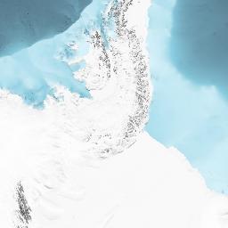
Latitude: -74.861050 * Longitude: -30.808980
Date/Time Start: 2021-03-02T14:25:01 * Date/Time End: 2022-04-29T09:25:01
Minimum DEPTH, water: 525 m * Maximum DEPTH, water: 525 m
Event(s):
SWS-WetCam1 (PS124_67-2) * Latitude: -74.861050 * Longitude: -30.808980 * Date/Time Start: 2021-02-28T07:46:55 * Date/Time End: 2025-01-01T00:00:00 * Elevation: -528.0 m * Location: Weddell Sea * Campaign: PS124 (GPF 19-2_039, COSMUS) * Basis: Polarstern * Method/Device: Mooring (MOOR) * Comment: Deployment: PS124_67-2, recovery: PS146
Parameter(s):
| # | Name | Short Name | Unit | Principal Investigator | Method/Device | Comment |
|---|---|---|---|---|---|---|
| 1 | DATE/TIME | Date/Time | Purser, Autun | Geocode | ||
| 2 | DEPTH, water | Depth water | m | Purser, Autun | Geocode | |
| 3 | Binary Object | Binary | Purser, Autun |
License:
Creative Commons Attribution 4.0 International (CC-BY-4.0) (License comes into effect after moratorium ends)
Status:
Curation Level: Enhanced curation (CurationLevelC)
Size:
1689 data points
Download Data (login required; moratorium until 2027-03-19)
Datasets with similar metadata
- Purser, A; Hehemann, L; Boehringer, L et al. (2021): Forward facing acoustic camera seafloor sonar data from the southern Weddell Sea, collected during POLARSTERN cruise PS124. https://doi.org/10.1594/PANGAEA.939341
- Hoppmann, M; Janout, MA; Allerholt, J et al. (2024): Raw physical oceanography data from mooring AWI245-5 in the Weddell Sea, January 2019 – April 2022. https://doi.org/10.1594/PANGAEA.971914
- Hehemann, L; Boehringer, L; Purser, A et al. (2021): Seafloor bathymetric maps derived from side scan data collected along OFOBS profiles during POLARSTERN cruise PS124 to the southern Weddell Sea. https://doi.org/10.1594/PANGAEA.939087