
Richter, Ulrike; Sigsgaard, Charlotte; Kroon, Aart (2025): Geomorphological map for the watershed of the Røde Elv, Disko Island, CW Greenland (QGis Map Package) [dataset]. PANGAEA, https://doi.org/10.1594/PANGAEA.974723
Always quote citation above when using data! You can download the citation in several formats below.
Published: 2025-02-14 • DOI registered: 2025-03-15
Abstract:
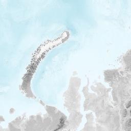
Almost a quarter of the Greenlandic freshwater input into the oceans stems from watersheds disconnected from the Greenland Ice Sheet. As the Ice Sheet shrinks, the relative importance of watersheds with comparatively little glacier cover will increase (Abermann et al., 2021). The watershed of the river Røde Elv on Disko Island (70° N, 54° W; 96 km²) is one of these. The area is characterised by a unique volcanic genesis with basalts, geothermal springs, and a typical mountainous periglacial landscape. A geomorphological mapping campaign was carried out to characterise the drainage basin and to explain the discharge patterns of the Røde Elv. The resulting map is presented in this contribution.
The stream orders and the extent of the watershed were calculated using the ArcticDEM (Digital Elevation Model) with a native spatial resolution of 2 m. A hydrologically corrected DEM with filled surface depressions was used to derive the accumulated flow using the Deterministic 8 method (O'Callaghan & Mark, 1984). The drainage river system was calculated based on the flow, resulting in six logarithmically scaled Horton-Strahler stream orders. The extent of the watershed was determined by identifying the area contributing to the discharge at the delta.
The geomorphological character of the study area is represented by landcover units, which were identified and schematised regarding their hydrological characteristics based on field observations, literature, and background knowledge (Richter, 2024: Table 1). This resulted in a classification of 19 landform classes as polygons, and the line classes debris flow and solifluction terraces. The map digitisation was conducted based on local knowledge and photographs taken during a field visit in August 2023, as well as several freely available base maps for remote areas (Dataforsyningen, Bing Maps, and Google Maps). In addition, an old geomorphological map of the southern part of the watershed was used as a reference (Andersen et al., 1976). A detailed description of the digitisation process and an analysis of the spatial patterns of the landforms, can be found in Richter (2024).
The map aims to provide an overview of the hydro-morphological structure and characteristics of the watershed. Both the valley sides and the valley floor are distinct geomorphological systems, reflecting the landscape heritage of the last glacial period. This is evident in the depositional processes at their transition, as indicated by the large active Holocene alluvial fans and talus deposits. Water infiltration is comparatively limited and highly variable on a small scale in the classes of rocks, talus deposits, unvegetated upper talus deposits, moraines, block glaciers and paraglaciation. This results in rapid and increasingly channelled surface runoff, controlled by the slope, slowing down only in depressions forming small lakes or when reaching the vegetated lower talus slopes. The latter are characterised by high water storage and evapotranspiration rates due to the soils and the high friction of the vegetation. Here, the drainage pathways are altered by features like landslides, patterned ground, or the flatter tops of the solifluction terraces, leading to higher infiltration rates. In the well-drained alluvial deposits and gravel, the infiltration rate is even higher. Finally, the largest water buffers are associated with the braided river system, lakes, and swamps which are characterised by a connection to the groundwater.
Geomorphology is an important explanatory factor for the highly variable discharge patterns of the Røde Elv on a diurnal to interannual scale, as it determines water availability and the capacity of water storage reservoirs. These water buffers are influenced not only by the seasonal variation in meteorology, but also by the interplay of aspect, elevation, slope, and geomorphological process activity, which collectively determine the distribution of landform classes shown on the geomorphological map (Richter, 2024).
Keyword(s):
Related to:
Richter, Ulrike (2024): Discharge pattern of the river Røde Elv, Disko Island, Greenland [Master Thesis] [thesis]. University of Copenhagen, https://curis.ku.dk/ws/files/396164664/Master_Thesis_Ulrike_Richter_Physical_Geography.pdf
References:
Abermann, Jakob; Langley, Kirsty; Myreng, Sille M; Rasmussen, Kerstin; Petersen, Dorthe (2021): Heterogeneous timing of freshwater input into Kobbefjord, a low‐arctic fjord in Greenland. Hydrological Processes, 35(11), e14413, https://doi.org/10.1002/hyp.14413
O'Callaghan, John F; Mark, David M (1984): The extraction of drainage networks from digital elevation data. Computer Vision and Image Understanding, 28(3), 323-344, https://doi.org/10.1016/S0734-189X(84)80011-0
Coverage:
Latitude: 70.000000 * Longitude: -54.000000
Date/Time Start: 2023-08-15T00:00:00 * Date/Time End: 2023-08-15T00:00:00
Event(s):
Comment:
This QGIS Map Package comprises the shapefiles of the geomorphological map for the watershed of the Røde Elv in CW Greenland (EPSG: 3413) published as Figures 3, 5 and 25 in Richter, U. (2024).
Additional reference: Andersen, B. D., Humlum, O., Jensen, J. B., Kraag, B. L., Krüger, J., Marquardsen, V., Mortensen, N. G., Nielsen, N., Nielsen, J., Olsen, B. S., Pedersen, L., Storm, J., Svensson, H., & Thomsen, H. H. (1976). Godhavn—Områdets Geomorfologi. Kursus i arktisk
Parameter(s):
| # | Name | Short Name | Unit | Principal Investigator | Method/Device | Comment |
|---|---|---|---|---|---|---|
| 1 | Binary Object | Binary | Richter, Ulrike | |||
| 2 | Binary Object (Media Type) | Binary (Type) | Richter, Ulrike | |||
| 3 | Binary Object (File Size) | Binary (Size) | Bytes | Richter, Ulrike | ||
| 4 | File content | Content | Richter, Ulrike | |||
| 5 | Horizontal datum | Horizontal datum | Richter, Ulrike |
License:
Creative Commons Attribution 4.0 International (CC-BY-4.0)
Status:
Curation Level: Enhanced curation (CurationLevelC)
Size:
3 data points
Download Data
Datasets with similar metadata
- Zastruzny, S; Elberling, B; Jensen, KH et al. (2024): Observed data and simulations results from Disko Island for thermal-hydrological investigations. https://doi.org/10.1594/PANGAEA.967138
- Zastruzny, S; Elberling, B; Jensen, KH et al. (2024): Soil temperature, soil water content and electric conductivity monitoring from Disko Island for thermal-hydrological investigations. https://doi.org/10.1594/PANGAEA.967145
- Zastruzny, S; Elberling, B; Jensen, KH et al. (2024): Field data from Disko Island for thermal-hydrological investigations. https://doi.org/10.1594/PANGAEA.967139