
Haas, Christian; Hendricks, Stefan; Krumpen, Thomas (2024): Laser altimeter data obtained over sea-ice during the CryoVEx campaign in May, 2006; profile CryoVEx_ARK_2006_SBLA_20060514T2100_85.51_-64.59_thr06_data_Vers5 [dataset]. PANGAEA, https://doi.org/10.1594/PANGAEA.970357, In: Haas, Christian; Hendricks, Stefan; Krumpen, Thomas (2024): Laser altimeter data obtained over sea-ice during the CryoVEx campaign in May, 2006 [dataset publication series]. PANGAEA, https://doi.org/10.1594/PANGAEA.970401
Always quote citation above when using data! You can download the citation in several formats below.
Published: 2024-07-12 • DOI registered: 2024-08-27
Abstract:
Sea ice surface roughness data were obtained during the CryoVEx campaign in May, 2006 with a Single Beam Laser Altimeter (SBLA) mounted inside an electromagnetic system (EM-Bird) towed at 10-30 m height above surface by a Helicopter (Unknown model). A method developed by Hibler (1972) was used to a) isolate the surface profile from low-frequency variations associated with the aircraft motion and b) to identify pressure ridge sails. The processing steps are described in https://epic.awi.de/id/eprint/56364/. We applied a ridge detection threshold of 0.6 m, which means that only sails higher 0.6 m are detected. Version and name of the processing routine: Laser_Altimeter_Processing_VS5_06_20.py (vers.5, Feb 22, 2024, https://gitlab.awi.de/sitem/sbla_processing.git). SBLA records (RIEGL - LD90) are provided at a sampling rate of 100 Hz. Sensor accuracy is 5 cm with a beam diameter at surface of 5.8 cm. This specific dataset was obtained on 20060514T2100. It includes recorded altimeter readings, the derived surface elevation and width/height/spacing of detected pressure ridge sails. Note on data quality: 5.8 cm . File name: [DMS/PANGAEA Campaing Identifier] + [DEVICE] + [DATE/TIME] + [LAT/LON] + [Detection Threshold] + [Object] + [Version] + [Format]
Supplement to:
Krumpen, Thomas; von Albedyll, Luisa; Bünger, Hans Jakob; Castellani, Giulia; Hartmann, Jörg; Helm, Veit; Hendricks, Stefan; Hutter, Nils; Landy, Jack; Lisovski, Simeon; Lüpkes, Christof; Rohde, Jan; Suhrhoff, Mira; Haas, Christian (2025): Smoother sea ice with fewer pressure ridges in a more dynamic Arctic. Nature Climate Change, https://doi.org/10.1038/s41558-024-02199-5
Related to:
Haas, Christian; Haapala, Jari; Hanson, Susanne; Rabenstein, Lasse; Rinne, Eero; Wilkinson, Jeremy (2006): CryoVEx 2006: field report. Alfred Wegener Institute, Helmholtz Centre for Polar and Marine Research, Bremerhaven, https://epic.awi.de/id/eprint/23329/
Related code / software:
Data processing report:
Suhrhoff, Mira (2021): Sea Ice Surface Roughness from Single Beam Laser Altimeter Measurements - Method Development and Comparison with Airborne Laser Scanner Profiles [thesis]. Universität Trier, hdl:10013/epic.30c63deb-b1f5-4c1e-927b-3d8a8d495b82
Coverage:
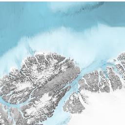
Median Latitude: 85.508913 * Median Longitude: -64.593526 * South-bound Latitude: 85.321452 * West-bound Longitude: -64.615128 * North-bound Latitude: 85.708403 * East-bound Longitude: -64.565331
Date/Time Start: 2006-05-14T21:03:02 * Date/Time End: 2006-05-14T21:22:29
Event(s):
CryoVEx_ARK_2006_SBLA_20060514T210302 * Latitude Start: 85.321452 * Longitude Start: -64.565946 * Latitude End: 85.708403 * Longitude End: -64.612006 * Date/Time Start: 2006-05-14T21:03:02 * Date/Time End: 2006-05-14T21:22:29 * O2A Registry URI: registry.o2a-data.de * Campaign: CryoVEx_ARK_2006 (CryoVEx_ARK 2006) * Basis: Helicopter * Method/Device: Single beam laser altimeter (SBLA)
Parameter(s):
License:
Creative Commons Attribution 4.0 International (CC-BY-4.0)
Status:
Curation Level: Enhanced curation (CurationLevelC)
Size:
218000 data points
Download Data
View dataset as HTML (shows only first 2000 rows)
Datasets with similar metadata
- Haas, C; Hendricks, S; Krumpen, T (2024): Laser altimeter data obtained over sea-ice during the CryoVex campaign in May, 2008; profile CryoVEx_ARK_2008_SBLA_20080502T1729_84.02_-65.17_thr06_data_Vers5. https://doi.org/10.1594/PANGAEA.970370
- Haas, C; Hendricks, S; Krumpen, T (2024): Laser altimeter data obtained over sea-ice during the CryoVex campaign in May, 2008; profile CryoVEx_ARK_2008_SBLA_20080502T1706_83.56_-65.17_thr06_data_Vers5. https://doi.org/10.1594/PANGAEA.970369
- Haas, C; Hendricks, S; Krumpen, T (2024): Laser altimeter data obtained over sea-ice during the CryoVex campaign in May, 2008; profile CryoVEx_ARK_2008_SBLA_20080502T1752_83.98_-65.17_thr06_data_Vers5. https://doi.org/10.1594/PANGAEA.970368
Users interested in this dataset were also interested in
- Bracher, A; Liu, Y; Wiegmann, S et al. (2025): Absorption coefficients by coloured dissolved organic matter from the East Greenland Sea measured at fixed stations with a Liquid Waveguide Capillary Cell system during POLARSTERN cruise PS107. https://doi.org/10.1594/PANGAEA.971585
- Haas, C; Hendricks, S; Krumpen, T (2024): Laser altimeter data obtained over sea-ice during the ARK-XII campaign in Jul-Sep, 1996; profile ARK-XII_SBLA_19960813T0957_86.67_144.85_thr06_data_Vers5. https://doi.org/10.1594/PANGAEA.969497
- Haas, C; Hendricks, S; Krumpen, T (2024): Laser altimeter data obtained over sea-ice during the ARK-XII campaign in Jul-Sep, 1996; profile ARK-XII_SBLA_19960820T1143_82.50_130.53_thr06_data_Vers5. https://doi.org/10.1594/PANGAEA.969505