


Andrews, John T (2021): Ice rafted debris and sortable silt from sediment core MD99-2323 [dataset]. PANGAEA, https://doi.org/10.1594/PANGAEA.936477
Always quote citation above when using data! You can download the citation in several formats below.
Published: 2021-09-28 • DOI registered: 2021-11-10
Abstract:
Weight (> 2 mm) and volume % of coarse sand fractions of laser-sized Malvern grain-size data and calculated % of the sortable silt fraction (10-63 µm) and the average size of that fraction.
Original grain-size data were produced by Dunhill (2005)
Related to:
Andrews, John T; Dunhill, Gita; Vogt, Christoph; Voelker, Antje H L (2017): Sedimentology of sediment core MD99-2323 [dataset]. PANGAEA, https://doi.org/10.1594/PANGAEA.876076
Andrews, John T; McCave, I Nick; Syvitski, Jaia (2021): A ~240 ka record of Ice Sheet and Ocean interactions on the Snorri Drift, SW of Iceland. Global and Planetary Change, 201, 103498, https://doi.org/10.1016/j.gloplacha.2021.103498
Source:
Coverage:
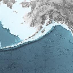
Latitude: 65.415500 * Longitude: -28.330500
Date/Time Start: 1999-08-01T00:00:00 * Date/Time End: 1999-08-01T00:00:00
Minimum DEPTH, sediment/rock: 0.015 m * Maximum DEPTH, sediment/rock: 17.505 m
Event(s):
MD99-2323 * Latitude: 65.415500 * Longitude: -28.330500 * Date/Time: 1999-08-01T00:00:00 * Elevation: -1062.0 m * Recovery: 17.86 m * Location: Snorri Drift * Campaign: MD114 (IMAGES V) * Basis: Marion Dufresne (1995) * Method/Device: Calypso Corer (CALYPSO)
Parameter(s):
| # | Name | Short Name | Unit | Principal Investigator | Method/Device | Comment |
|---|---|---|---|---|---|---|
| 1 | DEPTH, sediment/rock | Depth sed | m | Andrews, John T | Geocode | |
| 2 | AGE | Age | ka BP | Andrews, John T | Geocode | |
| 3 | Ice rafted debris | IRD | % | Andrews, John T | 2 mm | |
| 4 | Ice rafted debris | IRD | % | Andrews, John T | > 500 μm | |
| 5 | Ice rafted debris | IRD | % | Andrews, John T | > 250 μm | |
| 6 | Ice rafted debris | IRD | % | Andrews, John T | > 150 μm | |
| 7 | Percentage | Perc | % | Andrews, John T | Sortable-silt 10-63 μm | |
| 8 | Sortable-silt mean | SS | µm | Andrews, John T | average SS |
License:
Creative Commons Attribution 4.0 International (CC-BY-4.0)
Status:
Curation Level: Enhanced curation (CurationLevelC) * Processing Level: PANGAEA data processing level 3 (ProcLevel3)
Size:
1356 data points
Download Data
Datasets with similar metadata
- Andrews, JT; Smik, L; Belt, ST et al. (2021): Sortable silt distribution of sediment core MD99-2274. https://doi.org/10.1594/PANGAEA.931153
- Andrews, JT (2022): Results of calculations of various size fractions including the % of sediment > 240 µm (ice rafted) and sortable silt estimates in sediment core MD99-2317 (Table 2). https://doi.org/10.1594/PANGAEA.940540
- Knudsen, KL; Sondergaard, MKB; Eiriksson, J et al. (2008): Ice-rafted debris flow of sediment core MD99-2275. https://doi.org/10.1594/PANGAEA.681298