Schönfeldt, Elisabeth; Korup, Oliver; Pánek, Tomáš; Winocur, Diego (2021): Giant landslide inventory of Patagonia classified with the convolutional neural network AlexNet [dataset]. PANGAEA, https://doi.org/10.1594/PANGAEA.935704
Always quote citation above when using data! You can download the citation in several formats below.
Published: 2021-09-13 • DOI registered: 2022-07-12
Abstract:
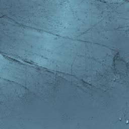
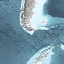
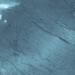
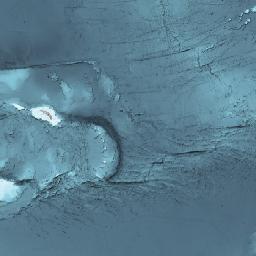
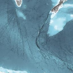
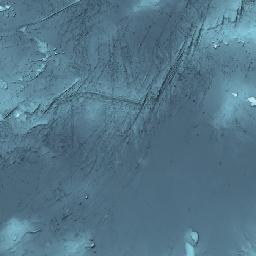
We used the convolutional neural network AlexNet to detect giant landslides (>10^8 m³) along basaltic plateaus in the Patagonian extra-Andean region east of the Andean Cordillera (40°S-53°S, 66°W-72°W). The network was trained using topographic information (elevation, roughness, curvature) from TanDEM-X data. The dataset includes the original raster dataset as well as a polygon dataset. Since the network was trained with terrestrial data, large water bodies, the ocean as well as human settlements are sometimes detected as landslides. We removed the falsely predicted landslides patches in the polygon file of the dataset. Using artificial intelligence can help to analyze large quantities of data within a short time. The dataset shows are widespread landslides in the region are and how they might have been underestimated in their size and number in landslide inventories.
Keyword(s):
Related to:
Schönfeldt, Elisabeth; Winocur, Diego; Pánek, Tomáš; Korup, Oliver (2022): Deep learning reveals one of Earth's largest landslide terrain in Patagonia. Earth and Planetary Science Letters, 593, 117642, https://doi.org/10.1016/j.epsl.2022.117642
Project(s):
Natural Hazards Group (NatHazGr)
Funding:
Coverage:
Latitude: -46.500000 * Longitude: -69.000000
Comment:
The Landslide prediction raster dataset contains the original landslide prediction (pixel value = 1).
Landslide CNN prediction polygons cleaned, is the shapefile where contiguous landslide pixels are transformed to polygons, but removed depending on their location relative to water bodies, the ocean and human settlements.
Parameter(s):
| # | Name | Short Name | Unit | Principal Investigator | Method/Device | Comment |
|---|---|---|---|---|---|---|
| 1 | File content | Content | Schönfeldt, Elisabeth | |||
| 2 | Binary Object (File Size) | Binary (Size) | Bytes | Schönfeldt, Elisabeth | ||
| 3 | Binary Object | Binary | Schönfeldt, Elisabeth |
License:
Creative Commons Attribution 4.0 International (CC-BY-4.0)
Status:
Curation Level: Basic curation (CurationLevelB)
Size:
18 data points
Download Data
Datasets with similar metadata
- Meier, WJ-H (2018): Glacier inventory for the Patagonian Andes, link to shape files. https://doi.org/10.1594/PANGAEA.891211
- Franco, C; Maldonado, A; Ohlendorf, C et al. (2024): Bulk chemistry determination of Laguna Meseta (LME), Central Patagonia. https://doi.org/10.1594/PANGAEA.961935
- Franco, C; Maldonado, A; Ohlendorf, C et al. (2024): Magnetic susceptibility of Laguna Meseta (LME), Central Patagonia. https://doi.org/10.1594/PANGAEA.961938