
Hendrizan, Marfasran; Kuhnt, Wolfgang; Holbourn, Ann E (2017): High resolution reconstruction of hydrological changes over the last 14 kyr from sediment core GIK18517-2 [dataset publication series]. PANGAEA, https://doi.org/10.1594/PANGAEA.880971
Always quote citation above when using data! You can download the citation in several formats below.
Published: 2017-09-25 • DOI registered: 2017-10-23
Abstract:
We present a high resolution (~20 to 100 years temporal resolution) reconstruction of hydrological changes in the Makassar Strait over the last 14 kyr from Core SO217-18517 retrieved off the Mahakam Delta (1°32.198'S, 117°33.756'E; 698 m water depth) during the SO217 Makassar-Java (MAJA) Cruise. Sea surface temperatures, based on Mg/Ca of Globigerinoides ruber and alkenone UK'37, and sea water d18O reconstructions, based on G. ruber d18O and Mg/Ca, in combination with sortable silt grain-size measurements and X-ray fluorescence (XRF) core scanner derived elemental data provide evidence for increased precipitation during the Bølling-Allerød (BA) and early Holocene and for warmer and more saline surface waters and a decrease in the intensity of the Indonesian Throughflow (ITF) during the Younger Dryas (YD). XRF derived Log (Zr/Rb) records, sortable silt data and increased sedimentation rates indicate decreased winnowing, interpreted as a slowdown of the ITF thermocline flow during the YD. We attribute this decline in ITF intensity to slowdown of the Atlantic Meridional Overturning Circulation (AMOC) during the YD. We suggest that changes in Makassar Strait surface hydrology during this interval of northern hemisphere cooling and southern hemisphere warming were related to a southward displacement of the Intertropical Convergence Zone.
Related to:
Hendrizan, Marfasran; Kuhnt, Wolfgang; Holbourn, Ann E (2017): Variability of Indonesian Throughflow and Borneo Runoff During the Last 14 kyr. Paleoceanography, 32(10), 1054-1069, https://doi.org/10.1002/2016PA003030
Project(s):
Coverage:
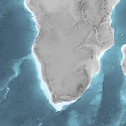
Latitude: -1.536630 * Longitude: 117.562600
Date/Time Start: 2011-07-30T04:27:00 * Date/Time End: 2011-07-30T04:27:00
Event(s):
License:
Creative Commons Attribution 3.0 Unported (CC-BY-3.0)
Size:
8 datasets
Download Data
Datasets listed in this publication series
- Hendrizan, M; Kuhnt, W; Holbourn, AE (2017): Age deterimination of sediment core GIK18517-2. https://doi.org/10.1594/PANGAEA.880963
- Hendrizan, M; Kuhnt, W; Holbourn, AE (2017): CaCO3 content of sediment core GIK18517-2. https://doi.org/10.1594/PANGAEA.880964
- Hendrizan, M; Kuhnt, W; Holbourn, AE (2017): Stable oxygen isotope ratio of Globigerinoides ruber of sediment core GIK18517-2. https://doi.org/10.1594/PANGAEA.880970
- Hendrizan, M; Kuhnt, W; Holbourn, AE (2017): Seawater δ¹⁸O reconstruction for sediment core GIK18517-2. https://doi.org/10.1594/PANGAEA.880965
- Hendrizan, M; Kuhnt, W; Holbourn, AE (2017): Mg/Ca ratio of Globigerinoides ruber of sediment core GIK18517-2. https://doi.org/10.1594/PANGAEA.880966
- Hendrizan, M; Kuhnt, W; Holbourn, AE (2017): Sortable silt in sediment core GIK18517-2. https://doi.org/10.1594/PANGAEA.880967
- Hendrizan, M; Kuhnt, W; Holbourn, AE (2017): UK'37 analysis and temperature reconstruction for sediment core GIK18517-2. https://doi.org/10.1594/PANGAEA.880968
- Hendrizan, M; Kuhnt, W; Holbourn, AE (2017): Element analysis of sediment core GIK18517-2. https://doi.org/10.1594/PANGAEA.880969
Datasets with similar metadata
- Schröder, JF; Holbourn, AE; Kuhnt, W et al. (2016): High-resolution sea surface temperature and surface seawater oxygen isotope composition reconstructions for sediment core GIK18515-3. https://doi.org/10.1594/PANGAEA.868623
- Turney, CSM; Jones, R; McKay, N et al. (2019): A global reconstruction of sea-surface temperatures for the Last Interglacial (129-116 kyr). https://doi.org/10.1594/PANGAEA.904381
- Schröder, JF; Kuhnt, W; Holbourn, AE et al. (2018): Deglacial stable oxygen isotope and SST records from the central Indonesian archipelago. https://doi.org/10.1594/PANGAEA.894085