Davies, Peter J; McKenzie, Judith A; Shipboard Scientific Party (2005): Close-up images of ODP Hole 133-821A [dataset]. PANGAEA, https://doi.org/10.1594/PANGAEA.796582
Always quote citation above when using data! You can download the citation in several formats below.
Published: 2005 (exact date unknown) • DOI registered: 2012-12-10
Related to:
Davies, Peter J; McKenzie, Judith A; Palmer-Julson, Amanda; et al. (1991): Proceedings of the Ocean Drilling Program, 133 Initial Reports. Proceedings of the Ocean Drilling Program, Ocean Drilling Program, 133, 1496 pp, https://doi.org/10.2973/odp.proc.ir.133.1991
ODP/TAMU (2005): JANUS Database. Ocean Drilling Program, Texas A&M University, College Station TX 77845-9547, USA; (data copied from Janus 2005-02 to 2005-06), http://www-odp.tamu.edu/database/
Further details:
Thumbnail gallery of close-up images from ODP Hole 133-821A [dataset]. https://www.pangaea.de/helpers/Cores.php?B=ODP&C=Leg133&S=133-821A_closeup&ID=796582
Project(s):
Ocean Drilling Program (ODP)
Coverage:
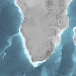
Latitude: -16.647000 * Longitude: 146.289500
Date/Time Start: 1990-09-15T03:15:00 * Date/Time End: 1990-09-16T17:10:00
Minimum Elevation: -224.0 m * Maximum Elevation: -224.0 m
Event(s):
133-821A * Latitude: -16.647000 * Longitude: 146.289500 * Date/Time Start: 1990-09-15T03:15:00 * Date/Time End: 1990-09-16T17:10:00 * Elevation: -224.0 m * Penetration: 400 m * Recovery: 382.94 m * Location: Coral Sea * Campaign: Leg133 * Basis: Joides Resolution * Method/Device: Drilling/drill rig (DRILL) * Comment: 43 cores; 400 m cored; 0 m drilled; 95.7 % recovery
Comment:
See further details for a thumbnail overview catalog.
Parameter(s):
| # | Name | Short Name | Unit | Principal Investigator | Method/Device | Comment |
|---|---|---|---|---|---|---|
| 1 | Sample code/label | Sample label | Shipboard Scientific Party | DSDP/ODP/IODP sample designation | ||
| 2 | Type | Type | Shipboard Scientific Party | |||
| 3 | Image number/name | Image no/name | Shipboard Scientific Party | |||
| 4 | File name | File name | Shipboard Scientific Party | |||
| 5 | Uniform resource locator/link to image | URL image | Shipboard Scientific Party |
License:
Creative Commons Attribution 3.0 Unported (CC-BY-3.0)
Size:
45 data points
Download Data
Datasets with similar metadata
- Davies, PJ; McKenzie, JA; Shipboard Scientific Party (2005): Section images from ODP Hole 133-821A. https://doi.org/10.1594/PANGAEA.798844
- Davies, PJ; McKenzie, JA; Shipboard Scientific Party (2005): Sample corelog of ODP Hole 133-821A. https://doi.org/10.1594/PANGAEA.794967
- Davies, PJ; McKenzie, JA; Shipboard Scientific Party (2005): Core/Section summary of ODP Hole 133-821A. https://doi.org/10.1594/PANGAEA.254064
Users interested in this dataset were also interested in
- WOCE Upper Ocean Thermal, UOT (2006): Water temperature real-time profiles from cruise NSWG97 (SCQC). https://doi.org/10.1594/PANGAEA.356766
- Schweingruber, FH (2007): Tree-ring measurements of Larix dahurica (Dahurican larch) from sample ANDRYULA-12. https://doi.org/10.1594/PANGAEA.588583
- WOCE Sea Level, WSL (2006): Daily sea level from coastal tide gauge station Boston in 1932 (Research quality database). https://doi.org/10.1594/PANGAEA.425929