


WOCE Sea Level, WSL (2006): Daily fast delivery sea level from coastal tide gauge station St_Johns in 1993 [dataset]. PANGAEA, https://doi.org/10.1594/PANGAEA.424896
Always quote citation above when using data! You can download the citation in several formats below.
Published: 2006-05-08 • DOI registered: 2006-06-05
Related to:
Further details:
Quality assessment of sea level data from station St Johns. St_Johns.txt
Project(s):
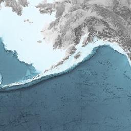
Coverage:
Latitude: 47.566700 * Longitude: -52.716702
Date/Time Start: 1993-07-01T12:00:00 * Date/Time End: 1993-12-31T12:00:00
Event(s):
St_Johns (g0223) * Latitude: 47.566700 * Longitude: -52.716702 * Date/Time Start: 1961-11-01T00:00:00 * Date/Time End: 2002-01-01T00:00:00 * Location: Canada * Campaign: SeaLevel * Method/Device: Tide gauge station (TGS)
Parameter(s):
License:
Creative Commons Attribution 3.0 Unported (CC-BY-3.0)
Size:
184 data points
Download Data
Datasets with similar metadata
- WOCE Sea Level, WSL (2006): Daily fast delivery sea level from coastal tide gauge station St_Johns in 1994. https://doi.org/10.1594/PANGAEA.424897
- WOCE Sea Level, WSL (2006): Daily fast delivery sea level from coastal tide gauge station St_Johns in 1995. https://doi.org/10.1594/PANGAEA.424898
- WOCE Sea Level, WSL (2006): Daily sea level from coastal tide gauge station St_Johns-A in 1993 (Research quality database). https://doi.org/10.1594/PANGAEA.432176